Southern California storm slams Santa Barbara, Ventura
Published in News & Features
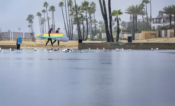
LOS ANGELES — California's wet winter continued Saturday as rain fell across the Southland, grounding flights coming in and out of Santa Barbara Airport and causing extensive road closures along the coast.
The soggy weather is expected to continue through Tuesday with the heaviest downfalls tapering off by mid-day Monday, according to the National Weather Service. However, even light rain can have an outsized impact when it comes on the heels of other heavy winter storms, said Robbie Munroe, a meteorologist with the National Weather Service.
"There is only so much room for that rain to go, so it could still be a little hazardous out there," he said.
The recent storm system was more severe in Santa Barbara and Ventura counties, but is expected to weaken as it moves into Los Angeles County. The Santa Barbara Airport canceled all flights going into and out of the airport Saturday around noon after several runways flooded. Officials at the small regional airport located about 7 miles from downtown Santa Barbara did not know when it would reopen and said they would reassess the situation after the rains had stopped.
"I urge everyone to check with their airlines for flight status before coming to the airport," a spokesperson said.
The wet weather, combined with an earlier storm over the Christmas and New Year's holiday was also responsible for the shuttering of all lanes on a 27-mile stretch of the 101 freeway extending from the junction of SR1 and Highway 1 to Winchester Road in Goleta due to heavy flooding. And, on Friday, Caltrans closed the 3.6-mile stretch of Topanga Canyon Boulevard known to experience mudslides between Pacific Coast Highway and Grand View Drive. The reopening of the roadways was "dependent on improved weather and road conditions," Caltrans said
The rainy system is expected to weaken as it moves south into Los Angeles County, but there is a 20% chance that recent burn areas, including the Palisades, Eaton and Bridge burn scars, could see mud slides. The National Weather Service also issued a flood advisory Saturday for the Santa Clarita Valley and the mountains in northwest LA County. The service warns minor flooding in low-lying and poor drainage areas as well as minor mud slides and debris flows is possible, especially near steep terrain and recent burn scars.
Further north in the Bay Area, a powerful combination of abnormally high king tides, large swells caused by a storm hanging out in the Eastern Pacific, and rainfall across the region has led to coastal flooding. The flooding is primarily around the Embarcadero in San Francisco and in parts of Marin County. There have also been reports of High Surf near Half Moon Bay in San Francisco and some flooding in the Elk Horn Slew area in the northern part of Monterey County on Hwy 1.
High tides could cause another round of coastal flooding on Sunday, but by Monday the region should be clear of any more coastal floods, said Dial Hoang, a meteorologist at the National Weather Service in Monterey.
L.A. County has already seen higher-than-normal precipitation this rainy season, with particularly strong storms hitting the region over the Christmas and New Year holidays. The final rainy days for 2025 helped pull California out of drought conditions, according to the U.S. Drought Monitor. And more rain may be on its way. The wettest months of the year are traditionally January and February.
©2026 Los Angeles Times. Visit latimes.com. Distributed by Tribune Content Agency, LLC.


Comments